The Radar Station at Sornfelli

| Set |

| Set CTO |

| Miniature Sheet |

| Miniature Sheet CTO |

| First Day Cover |

| First Day Cover MS |

| First Day Cover block of 4 |

| Block of 4 |
The Faroe Islands and the Cold War
- 60 Years at Sornfelli
During World War II, the Faroe Islands were occupied by Great Britain. During the war, the British built a military airport at Sørvágur on Vágar, and several radar stations around the Islands, monitoring the waters and airspace around the Faroes.
60 years since the radar base at Sornfelli was taken into use The Faroese radar stations played an essential role in the Arctic supply convoys, mainly transporting American military equipment to the Soviet port cities of Murmansk and Arkhangelsk.
The British also set up a so-called Loran (Long Range Navigation) station in Vágur on Suðuroy to obtain more precise navigational data at sea and in the air.
After the war, Denmark regained sovereignty over the Faroe Islands and Greenland (Iceland had then completely seceded from the Danish kingdom in 1944). The USA showed interest in the LORAN station in the Faroe Islands and offered to overtake its operation. Denmark, however, having learned from the signing of unfavourable agreements regarding the American military presence in Greenland, rejected the offer and hastily decided to operate the station itself in 1946, even though they did not have qualified personnel for the task.
The Referendum of 1946 – Home Rule Act 1948
Denmark recognized that the separation during the war had changed the relationship between Denmark and the Faroe Islands. During the five-year British occupation, the desire for increased self-determination had grown in the islands. After the war, negotiations began for the Faroe Islands’ future position in the Danish kingdom and political authority. The talks dragged on without the parties’ having reached an agreement - and the Faroese were also divided among themselves. Therefore, Denmark formulated a home rule proposal, which was submitted to the Faroese Parliament. But even then, no agreement was reached. The consequence was that in 1946 the Faroese Parliament called a referendum on whether the Faroese wanted extended home rule or secession from Denmark. The referendum showed a slight majority in favour of secession among the votes cast - but was soon cancelled by the Danish government. Instead, in 1948, the Home Rule Act was introduced, with expanded powers for the Faroese parliament and national government.
When Denmark joined NATO in 1949, the Faroe Islands and Greenland automatically became members. It caused quite a bit of dissatisfaction in the Faroe Islands. But in response to a question from the Faroese member of parliament, Poul Niclassen, whether the Danish government had violated its obligation to submit the conclusion of intergovernmental agreements concerning the Faroe Islands to the Lagtinget – the Faroese parliament. Prime Minister Hans Hedtoft replied that it was a political treaty that fell outside the obligation to submit, specified in home rule legislation.
Denmark did not have the military resources to defend the North Atlantic parts of the kingdom effectively. The Faroe Islands and Greenland defence was therefore subordinated to SACLANT, NATO’s Atlantic Command in the USA. In the event of war, forces from Great Britain would carry out the direct defence of the Faroe Islands.
Faroe Islands Command
In 1951, the Danish Navy established the Faroe Islands Marine District, later the Faroe Islands Command, to carry out sovereignty assertion, fisheries inspection, and rescue tasks in the Faroe Islands. The studies were carried out using ships that were already available - but in 1963, the navy got the new inspection ships of the Hvidbjørnen class, built especially for North Atlantic conditions and equipped with Alouette helicopters. At the same time, the new Marine station was constructed at “Hoyvíkstjørn” on the outskirts of Tórshavn and put into use in 1965.
NATO’s interest in the Faroe Islands was limited during the first years. NATO aircraft could use Vágar airport for emergency landings - and the large fjord, “Skálafjørður,” would become an anchorage point for NATO ships and submarines in case of war.
Loran C and the Polaris missiles
However, during the fifties and with the technological advances of the Cold War, the strategic and tactical importance of the Faroe Islands changed due to their location in the middle of the North Atlantic, between the two main actors of the Cold War, the United States, and the Soviet Union. The power play of the superpowers unfolded on many levels - on land, the seas, and in the air. The increased military traffic required coordination and precise position fixing - and in the late fifties, the US Coast Guard installed 30 Loran C radio beacons all around the islands. One of these facilities was the Loran C station in Eiði on the northernmost part of Eysturoy, commissioned in 1960. The station was established with permission from the Danish government, paid for by the US Coast Guard, and operated by the Danish Lighthouse Service.
Loran C, Eiði, with its 190-meter-high transmitting mast, was a master station supported by slave stations around the North Atlantic. It improved navigation and position fix for NATO naval units. Among other things. For aircraft carriers, submarines, and military aircraft. In particular, the system was necessary for the first generation of submarine-based Polaris nuclear missiles, whose limited range meant that the subs had to operate in the Norwegian Sea for the missiles to reach their targets in the Soviet Union.
However, Loran C’s military importance was quickly overtaken by technical developments. Improved navigational systems, satellite navigation, i.e., the military predecessor to today’s GPS navigation, were more accurate. In addition, the newer generations of the Polaris missiles had a doubled range, which meant that the Polaris submarines could operate from longer distances than the Norwegian Sea.
The radar station at Sornfelli
In 1963, Faroese could ascertain that the mountain Sornfelli, which towers over the bottom of the Kaldbaksfjørður north of Tórshavn, had had its peak equipped with two strange-looking white domes. After three years of construction work, the radar station at Sornfelli, with the official designation, “NATO Early Warning Station Site 09,” was finally finished.
One dome was equipped with a large horizontal radar and the other with an equally sizeable vertical radar. Eighty meters down into the mountain itself, an operations bunker had been drilled out, with a shaft leading up to the two radars, which together provided the radar operators with a three-dimensional situational picture of the North Atlantic waters and airspace.
Further down the mountainside, in “Mjørkadalur” (Fog Valley) above “Kaldbaksbotnur,” an administration and residential building was built, completed in 1964. This was called Air Base Thorshavn and was attached to the Danish air force, which served the Sornfelli base installations. A part of the agreement with NATO was that the staff, radar operators, technicians, and service personnel had to be Danish, even though the radar station was a decidedly NATO project. For inscrutable reasons, the Danish government believed that this would make the presence of the radar base more palatable to the Faroese population.
Early Warning – but for whom?
In the usual literature about the radar station at Sornfelli, it appears that it was an extension of the American-Canadian DEW (Distant Early Warning) chain, which was supposed to warn the United States of attacks by Soviet bombers. In an article in “International Politics - Scandinavian journal for international studies,” from September 2020, military analyst Esben Salling Larsen, from the Danish Defence Academy, points out, however, that this was not necessarily the case.
Salling points out that in American sources about the DEW line, Sornfelli is not mentioned as part of the line. From 1961 to 65, the DEW line was extended with a constant presence of four warships with radar and four radar surveillance aircraft in the GIUK line, which ran from Greenland, over Iceland, to Scotland. But Sornfelli was, as I said, not a part of this extension.
Salling further demonstrates that, according to NATO sources, the radar station was built as part of NATO’s “Air Defence Ground Environment” (NADGE), a chain of airspace surveillance radars and control stations, which were established along NATO’s outer border with the Soviet Union, from Norway to Turkey. The purpose was to warn of tactical attacks against European NATO forces and territories. In this expansion of NATO’s warning network, the station at Sornfelli was one of the stations to be built first.
At the same time, the Faroese airspace in the NATO context was taken over by NATO’s Supreme Commander in Europe (SACEUR), while the Supreme Commander in the Atlantic (SACLANT) continued the naval responsibility around the Faroe Islands.
Therefore, the radar station in Sornfelli was part of Europe’s naval and air defence, which had to support anti-submarine warfare and the fight against the Soviet surface ships and air forces that protected the submarines. An eye had also to be kept out for a low-flying cruise and sea-target missiles that threatened NATO ships and aircraft - and after the radar station got a new three-dimensional radar in the 80’s and the ability to receive and forward radar images from NATO’s radar aircraft, you could register missiles that went below radar height. Thereby, the station became an essential part of electronic warfare – and, as part of the NADGE chain, could support high-priority tactical operations, according to Salling.
As a consequence of the apparent end of the Cold War in the 90s, the radar station at Sornfelli was closed in 2007.
However, there are plans to reopen it - but that’s another story.
Anker Eli Petersen
Faroe Islands - Recommended stamp issues


WOPA+ recommended stamp issues

| Avatar - Fire and Ash |
| Issued: 03.12.2025 |
| ›New Zealand |
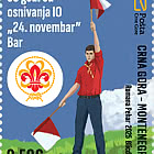
| 50th Anniversary of the Founding of the 24th November Bar Scout |
| Issued: 24.11.2025 |
| ›Montenegro |
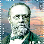
| Krisjanis Valdemars |
| Issued: 02.12.2025 |
| ›Latvia |

| Sign Language - Good |
| Issued: 02.12.2025 |
| ›Bosnia and Herzegovina - Republic of Srpska |

| In Memory of the Fallen and Murdered on October 7, 2023 |
| Issued: 08.10.2025 |
| ›Israel |


| Annual Collection Folder (New York) |
| Issued: 05.12.2025 |
| ›United Nations |

| Year Set |
| Issued: 24.11.2025 |
| ›Isle of Man |
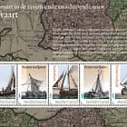
| Shipping in the 17th and 18th Centuries - Peat Shipping |
| Issued: 05.12.2025 |
| ›Netherlands |