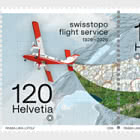
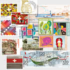
Switzerland from the sky then and now
The three related special stamps celebrate 100 years swisstopo flight service and show how important bird’s eye views are for Switzerland. The focus is on the Twin Otter the workhorse of the swisstopo flight service. When you’re holding a Swiss topographical or hiking map, you rarely think about how it was created. It’s a journey that takes us high up in the sky to 7,500 metres above sea level, where Carlo Bosco can be found. He is part of the swiss topo flight service, flying for around 70 hours a year to capture Switzerland anew, image by image. His work place is the robust Twin Otter, which is celebrating its 50th anniversary this year.
Carlo Bosco, what fascinates you personally about aerial views?
I almost always see Switzerland at its best during my flights, because we only fly in cloudless weather. Blooming landscapes, deep blue lakes, colourful rock formations: the diversity impresses me every time. But there’s also another side to it. During rapid mapping missions, we experience natural disasters up close. Often, I don’t realize the extent of the damage until the mission is over.
Many people don’t know that topographical and hiking maps are based on aerial images. How do you explain to laypeople how an accurate map is created from a photo?
We always start with aerial images. We link these to satellite data and reference points on the ground, so that each image is located with pixel perfect precision. We then put the individual images together and superimpose them on our elevation model to create a corrected composite image an orthophoto, known to us as a SWISSIMAGE or in the swisstopo app as an aerial photo. Because we photograph from several angles, the images can be read in three dimensions, resulting in the TLM digital landscape model. And that’s the basis for the maps we use every day.
What happens after the photos are taken in the plane?
After the flight, we calculate our exact flight path. Then we check every individual image: was the wind too strong? Have any shadows from clouds crept into the photos? Were there any reflections of roofs or lakes? Things like that distort the images and don’t meet our quality requirements. Were there any reflections of roofs or lakes? Things like that distort the images and don’t meet our quality requirements.
The anniversary of the Twin Otter coincides with the 100th anniversary of the flight service. What makes this plane so special?
It has excellent flying properties for survey flights: it’s fast enough to reach our target regions quickly, and slow enough for precise turns in narrow valleys. It can take off and land on short or unpaved runways, so there’s virtually no airfield in Switzerland we can’t fly to. The Twin Otter is everybody’s darling.
The flight service was founded in 1926. How were photos taken back then?
At the beginning, the planes had no cabins. The pilots and observers sat in the open air, so they had to wrap up warmly, and cameras were operated with thickly lined leather gloves. The aerial photos are available to everyone free of charge on map.geo.admin.ch under the search term “Journey through time”. An anniversary volume on the history of the flight ser- vice will be published this year.