Franking Labels - Villages

| Set |

| Set CTO |

| First Day Cover |

| First Day Cover single stamp |
On Suðuroy’s east side, there is a 7-kilometre-long fjord, Trongisvágsfjørður. In this fjord, which stretches from southeast to northwest, we find the ancient settlements of Froðba, Tvøroyri, Trongisvágur, Øravíkslíð and Øravík, which today have more or less grown together into Suðuroy’s largest city, Tvøroyri municipality.
Froðba
At the northeastern mouth of the fjord lies the old settlement Froðba with roots dating back to the Middle Ages. According to a local legend, Froðba must be the oldest settlement in the Faroe Islands. Its name refers to the legendary Danish king Frode, who founded a settlement there according to the legend - hence the name. This must be taken with a grain of salt - the name probably refers to one of the first settlers of the place and means something like Frode’s settlement or Frode’s land. Froðba is located in a very scenic area on the lowlands, a little inside the promontory Froðbiarnípa. Along the beach, we find ancient basalt columns bearing witness to violent volcanic activity dating back approx. Fifty million years ago when the Faroe Islands came into being.
The franking label motif shows one of Froðba’s old town districts, “uppi á Hamri,” where the well-known Faroese poet Poul F. Joensen lived.
Tvøroyri
Somewhat paradoxically, Tvøroyri is the youngest settlement, located on the northern shore of the fjord, between Froðba and Trongisvágur. The area was once part of Froðba’s outskirts, but when the Royal Monopoly trade established a branch on the Tvøroyri isthmus in 1836, the settlement began to grow - especially after the abolition of the Monopoly trade in 1856. Private individuals took over the trading business, which over time expanded with increased shipping and fishing industry. At the turn of the last century, Tvøroyri had grown into one of the Faroe Islands’ largest towns with the largest fishing industry.
The franking label depicts the so-called “Kirkjubrekka” - the road up the hill to the church. The parish church was initially located in Froðba, but when the new settlement at Tvøroyri began to grow, it was decided to move the old church to Tvøroyri in 1856. From 1880 until the turn of the last century, the number of inhabitants in the parish doubled. It was therefore decided to build a new and larger church. The Danish architect Viggo Bertram designed the church - and emphasised that it should be able to withstand the harsh Faroese weather conditions, with intense storms and lots of rainfall. It left a unique mark on the church’s architecture; the solid half-timber work was bolted to a foundation of basalt stone, which had already been bolted to the rock foundation. It can be said that the church in Tvøroyri was built according to Matthew’s well-known parable about “building one’s house on a rock.”
The church was prefabricated in Norway - and in 1905, work began erecting the structure. Three years later, in 1908, the new beautiful church was ready for use.
Trongisvágur
At the bottom of the fjord lies Trongisvágur, which like Froðba, is an old settlement that has grown together with Tvøroyri. From ancient times, Trongisvágur consisted of several districts along the river “Stórá,” which runs through the territory and meanders into the fjord. The stamp motif depicts one of these districts, “í Húsgarði.”
Over the past 40 years, Trongisvágur has undergone significant changes. A sports hall and later a football field were built at Stórá. There are a kindergarten, school and camping facilities on-site in addition to the usual expansions of buildings and infrastructure.
The beautiful natural surroundings include, among other things, an old pine grove with hiking trails - and along the west coast behind the settlement, magnificent geological formations of the oldest volcanic basalt layers are only visible on Suðuroy and the westernmost islands, Mykines and Vágar. Rangabotnur, with its coal seams formed in violent volcanic activity, lies southwest of the settlement. 50 million years ago. Coal was mined here almost a century ago - and from Rangabotnur towards Drelnes on the south side of the fjord, we can still see the woodwork remains in the cableway that brought coal down from the mines for further transport.
Hov
In the fourth and last franking label, we leave Trongisvágsfjørður and go a little further south to the settlement “Hov” by Hovsfjørður. Hov is also an ancient settlement with roots in the Viking Age. The village is often mentioned in the Saga of the Faroese as the home of Havgrímur Illi, chief of the southern part of the Faroe Islands. “Hov” means temple/house of sacrifice, where people sacrificed and worshipped the Norse gods in the Viking Age. It is said about Havgrímur that he was “blótmaður mikil”, i.e. a man offering great gifts to the gods.
In the mountainside above Hov, along the old road to the north, we find impressive basalt columns from the volcanic activity which formed the Faroe Islands. West of the settlement lies the large waterfall Foldaráfossur in the river Hová. In the fjord near Hov, there is the small islet, “Hovshólmur” - and since the eighties, salmon have been farmed in the fjord. Down by the harbour facility is a small museum, art gallery and café in the old commercial building.
On the franking label, we see the church tower in the background. The church originally stood in Vágur but was moved to Hov in 1942 when Vágur erected a larger church in 1939.
Anker Eli Petersen
Faroe Islands - Recommended stamp issues


WOPA+ recommended stamp issues

| Avatar - Fire and Ash |
| Issued: 03.12.2025 |
| ›New Zealand |
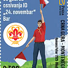
| 50th Anniversary of the Founding of the 24th November Bar Scout |
| Issued: 24.11.2025 |
| ›Montenegro |
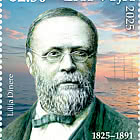
| Krisjanis Valdemars |
| Issued: 02.12.2025 |
| ›Latvia |

| Sign Language - Good |
| Issued: 02.12.2025 |
| ›Bosnia and Herzegovina - Republic of Srpska |

| In Memory of the Fallen and Murdered on October 7, 2023 |
| Issued: 08.10.2025 |
| ›Israel |

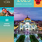
| Annual Collection Folder (New York) |
| Issued: 05.12.2025 |
| ›United Nations |

| Year Set |
| Issued: 24.11.2025 |
| ›Isle of Man |
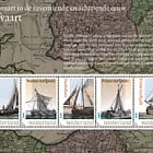
| Shipping in the 17th and 18th Centuries - Peat Shipping |
| Issued: 05.12.2025 |
| ›Netherlands |